Our planet is always changing. Forests shrink or grow. Rivers move. Cities expand. Ice melts. These changes are often too big to see from the ground. But from space, the story becomes clear. That is where satellite image processing apps come in. They turn raw space data into simple, colorful images that help us understand what is happening to Earth.
TLDR: Satellite image processing apps help you see how the Earth changes over time. They turn complex satellite data into simple maps and visuals. Many tools are easy to use and even free. With the right app, you can track deforestation, climate change, urban growth, and more in just a few clicks.
Let’s explore how these apps work and which ones are worth trying. No science degree needed. We will keep it simple and fun.
What Is Satellite Image Processing?
Satellites take pictures of Earth from space. These images capture light beyond what our eyes can see. Not just red, green, and blue. They also capture infrared and other wavelengths.
But raw satellite images are not always useful right away. They can look flat or dull. Satellite image processing apps enhance these images. They:
- Highlight vegetation health
- Detect water bodies
- Measure land temperature
- Track changes over time
In short, they turn data into answers.
Why Environmental Monitoring Matters
Every year, the planet faces new challenges. Forest fires. Floods. Drought. Pollution. Rising sea levels.
Governments use satellite apps to plan cities. Scientists use them to study climate change. Farmers use them to monitor crops. Even students use them for school projects.
The best part? Many powerful tools are open to the public.
What to Look for in a Good App
Not all satellite apps are the same. Some are beginner-friendly. Others are advanced and technical.
Here are a few things to check before choosing one:
- Ease of use – Is the interface simple?
- Data availability – Does it offer free satellite imagery?
- Analysis tools – Can it measure changes over time?
- Download options – Can you export images and reports?
- Cloud access – Does it work in your browser?
Now, let’s look at some of the best satellite image processing apps available today.
Top Satellite Image Processing Apps
1. Google Earth Engine
This is a favorite among researchers. It works in the cloud. That means you do not need a supercomputer.
It provides access to decades of satellite data. You can analyze forests, water, and climate trends.
Best for: Large-scale environmental studies.
Why it’s cool: It processes huge datasets very fast.
2. QGIS
QGIS is free and open-source. It runs on your computer. It supports plugins that process satellite imagery.
It has strong mapping tools. You can create detailed environmental maps.
Best for: Students and professionals who want control.
Why it’s cool: Tons of community support and plugins.
3. SNAP (Sentinel Application Platform)
This tool focuses on Sentinel satellite data from the European Space Agency.
It is powerful for radar and optical image processing.
Best for: Monitoring oceans, forests, and land changes.
Why it’s cool: Advanced scientific analysis tools.
4. ArcGIS Earth and ArcGIS Pro
This is a professional-grade platform. It offers advanced spatial analysis features.
It is widely used by environmental agencies and city planners.
Best for: Professional environmental management.
Why it’s cool: Excellent visualization and analysis tools.
5. EO Browser
This one is very beginner-friendly. It runs in your browser.
You can compare images from different dates side by side. Great for spotting change.
Best for: Quick environmental checks and learning.
Why it’s cool: No installation needed.
Comparison Chart
| App | Ease of Use | Best For | Cloud Based | Free Version |
|---|---|---|---|---|
| Google Earth Engine | Medium | Large-scale analysis | Yes | Yes (research use) |
| QGIS | Medium | Custom mapping | No | Yes |
| SNAP | Advanced | Scientific research | No | Yes |
| ArcGIS Pro | Medium to Advanced | Professional projects | Partial | Limited trial |
| EO Browser | Easy | Quick comparisons | Yes | Yes |
Real-World Environmental Use Cases
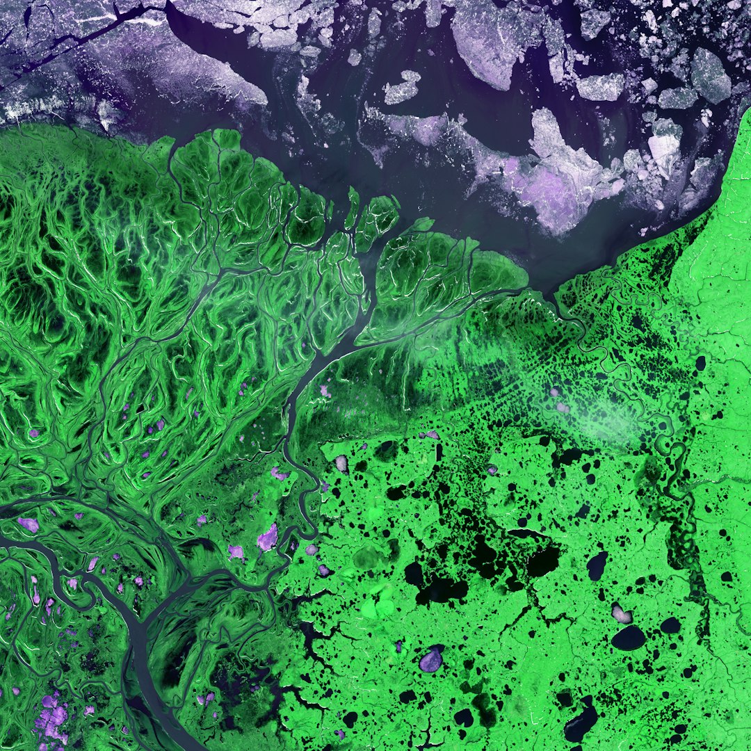
1. Tracking Deforestation
Satellite apps detect changes in tree cover. Healthy vegetation reflects infrared light strongly. When trees are cut down, that signal drops.
Apps calculate something called NDVI. That stands for Normalized Difference Vegetation Index. Do not worry about the name. Just remember: higher value means healthier plants.
This helps governments respond to illegal logging faster.
2. Monitoring Water Levels
Floods can reshape land in days. Drought can slowly dry lakes.
Satellite apps measure surface water area. They compare images over time. This shows expansion or shrinkage.
It helps cities prepare for disasters.
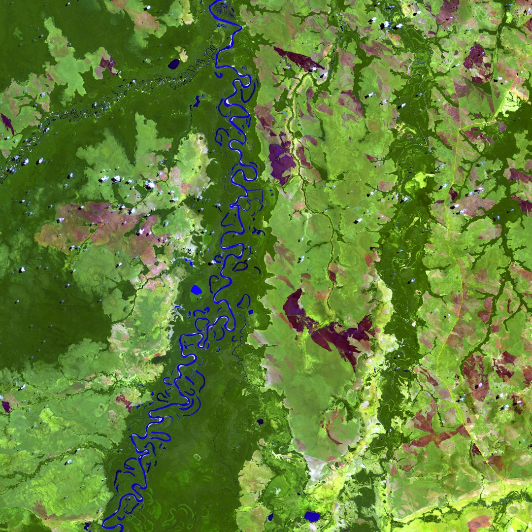
3. Measuring Urban Growth
Cities grow quickly. Fields turn into roads. Forests turn into houses.
Satellite apps highlight built-up areas. They show how cities spread year after year.
This supports smarter urban planning.
4. Observing Climate Change Effects
Glaciers retreat slowly. But satellites record every stage.
Apps compare historical and current images. You can literally see ice shrinking.
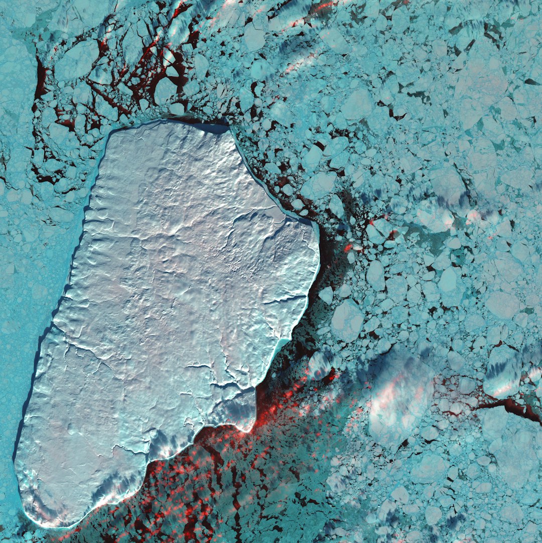
This visual proof makes climate change easier to understand.
How Beginners Can Get Started
Starting is easier than you think.
- Pick a simple app like EO Browser.
- Select a location you care about.
- Choose two different dates.
- Compare the images.
Look for changes in vegetation, water, or buildings.
Then try more advanced tools if you feel confident.
Tips for Better Analysis
- Use cloud-free images for clearer results.
- Compare the same season across different years.
- Zoom out first to understand big patterns.
- Use vegetation indices to measure plant health.
Small adjustments can lead to clearer insights.
The Future of Satellite Image Processing
Technology keeps improving. Satellites are becoming smaller and cheaper. They capture sharper images. They update more often.
Artificial intelligence is also changing the game. AI can:
- Detect wildfires early
- Predict crop yields
- Spot illegal mining activity
- Analyze pollution levels
In the future, environmental monitoring may become real time.
Imagine getting an alert when forest loss begins. Or when a river changes course. That future is not far away.
Why This Matters to You
You do not need to be a scientist to care about Earth.
Satellite image processing apps give you a new perspective. You see the planet as one connected system. Forest loss in one country affects weather in another.
When you explore satellite data, you become more informed. More aware. More empowered.
The planet sends signals every day. From melting glaciers to rising cities. These apps help us read those signals clearly.
And the best part? The view from space is open to almost everyone.
All it takes is curiosity. And a few clicks.
